

Visual improvements add more detail to Google Maps
In the coming months, the detailed street maps will be rolled out in three major cities including London, New York, and San Francisco with other cities to join the list thereafter.
- Country:
- United States
Google said Tuesday that it is rolling out new visual improvements that will bring even more detail and granularity to Google Maps. The update will be visible everywhere from the biggest metropolitan areas to small, rural towns.
With a new color-mapping algorithmic technique, Google Maps will give a more colorful and accurate view of the world. Now users can easily identify natural features and distinguish tan, arid beaches, and deserts from blue lakes, rivers, oceans, and ravines. Starting this week, a more colorful and easy-to-understand representation of the world will be visible on the map.
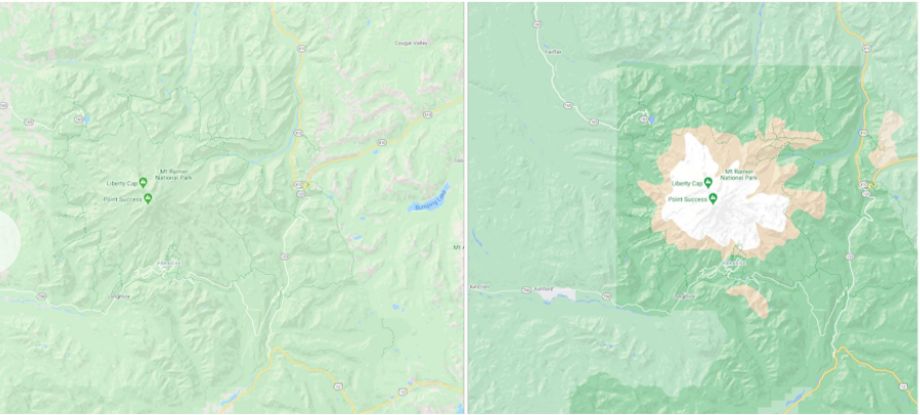
Google Map: Mt. Rainier National Park / Left: Old View, Right: New
In addition to color mapping, users will soon be able to see a highly detailed view of streets (accurate shape and width of a road), sidewalks, crosswalks, and pedestrian islands right from the map. In the coming months, the detailed street maps will be rolled out in three major cities including London, New York, and San Francisco with other cities to join the list thereafter.

"Since it launched 15 years ago, Google Maps has redefined what it means to be a map–evolving from a powerful navigational tool to a robust daily companion that also offers helpful information about where to go and what to do. With this update, Google Maps has one of the most comprehensive views of natural features on any major map app—with availability in all 220 countries and territories that Google Maps supports. That's coverage for over 100M square kilometers of land, or 18 billion football fields," Google wrote in a blog post.


 Google News