NASA's ICESat-2 maps ice sheets melting in Antarctica resulting sea level rise
NASA's ICESat-2 -- launched less than three months ago -- has mapped melting ice sheets in Antarctica and the resulting sea level rise across the globe, which could help improve climate forecasts.
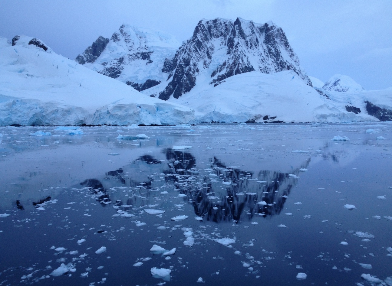
The Ice, Cloud and land Elevation Satellite-2 (ICESat-2) is measuring the height of sea ice to within an inch, tracing the terrain of previously unmapped Antarctic valleys, surveying remote ice sheets, and peering through forest canopies and shallow coastal waters.
With each pass of the ICESat-2 satellite, the mission is adding to datasets tracking Earth's rapidly changing ice.
Researchers are ready to use the information to study sea level rise resulting from melting ice sheets and glaciers. In topographic maps of the Transantarctic Mountains, which divide East and West Antarctica, there are places where other satellites just can not see.
Some instruments do not orbit that far south, others only pick up large features or the highest points and so miss minor peaks and valleys.
With an early pass of ICESat-2, scientists started to fill in those details.
"We're able to measure slopes that are steeper than 45 degrees, and maybe even more, all through this mountain range," said Benjamin Smith, a glaciologist with the University of Washington and member of the ICESat-2 science team.
As ICESat-2 orbits over the Antarctic Ice Sheet, the photon returns reflect from the surface and show high ice plateaus, crevasses in the ice 20 metres deep, and the sharp edges of ice shelves dropping into the ocean.
These first measurements can help fill in the gaps of Antarctic maps, Smith said, but the key science of the ICESat-2 mission is yet to come.
As researchers refine knowledge of where the instrument is pointing, they can start to measure the rise or fall of ice sheets and glaciers.
"Very soon, we'll have measurements that we can compare to older measurements of surface elevation," Smith said.
"And after the satellite's been up for a year, we'll start to be able to watch the ice sheets change over the seasons."
Sea ice of different thickness and bumpiness is broken up by the cracks between floes, called leads, in this graph of photon returns from ICESat-2 as it orbits over the Weddell Sea in Antarctica.
When sea ice first forms on polar oceans, before the snow falls on it and wind smashes it into other floes, it is thin, flat and smooth.
Which makes it a good place to test out how precise ICESat-2 data is since long stretches should all be nearly the same height, said Ron Kwok, a sea ice scientist at NASA's Jet Propulsion Laboratory in the US.
"The fresh ice is totally flat to within a couple centimetres," Kwok said.
The first months of ICESat-2 data collected over the Arctic and Antarctic sea ice reveal thin ice, thick ice, and features such as ice ridges.
Areas of open water in the cracks between the ice floes, called leads, stand out in the data because of the difference in reflectivity between ice and water.
By comparing the height of that water surface in the leads with the height of the ice, scientists are estimating ice freeboard and thickness.
With the high precision of ICESat-2, plus the satellite's six beams taking data simultaneously, researchers will have an unprecedented understanding of the thickness of sea ice, which will be used to help improve climate modelling and forecasts.
The ability to identify newly formed, thin ice will help researchers track the seasonal changes in remote polar regions, and understand the processes that drive those processes.
The ice-thickness data will also help scientists improve computer models of how sea ice responds to Arctic warming, as well as forecasts of sea ice cover.
(With inputs from agencies.)
- READ MORE ON:
- Sea ice
- Balance sheet
- Sheet pan
- Bed sheet
- Ice sheet
- Greenland ice sheet
- Height
- Satellite
- Communications satellite
- The Georgia Satellites
- Performance improvement
- NBA Most Improved Player Award
- Home improvement
- Name change
- Changing room
- Changing table
- Orbit
- Earth's orbit
- Geostationary orbit
- Antarctic Ice
ALSO READ
Scientists investigate thousands of dead Antarctic penguins for bird flu
Earthquake measuring 5.3 hits Chamba district of Himachal Pradesh.
Science News Roundup: Scientists investigate thousands of dead Antarctic penguins for bird flu; White House directs NASA to create time standard for the moon and more
Science News Roundup: White House directs NASA to create time standard for the moon; Scientists investigate thousands of dead Antarctic penguins for bird flu and more
Health News Roundup: Scientists investigate thousands of dead Antarctic penguins for bird flu; CVS Caremark to cover Perrigo's birth control pill in US at zero cost for plan sponsors and more


