

Cape Town’s road closures ahead of SONA
The City appealed to road users to familiarise themselves with the road closures and to plan their routes accordingly.
- Country:
- South Africa
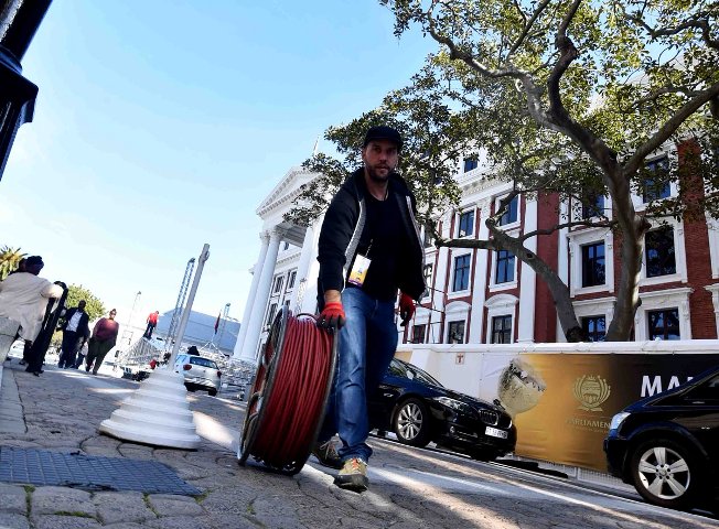
The City of Cape Town's traffic service has advised the public of road closures and traffic restrictions that will come into effect ahead of the State of the Nation Address (SONA).
The City appealed to road users to familiarise themselves with the road closures and to plan their routes accordingly.
Traffic congestion is expected to start on Wednesday from 5 pm until 10 pm, as the rehearsals will be underway.
The following roads will be closed from 5 pm until 10 pm on Wednesday:
Bureau Street, between Adderley and Parliament StreetsSpin Street, between Corporation and Parliament Streets
Parliament Street, between Parliament and 35m from Longmarket Street (excluding parking garage access point)
Plein Street, between Roeland and Longmarket Streets
St. John's Road, between Roeland and Vrede Streets
Mostert Street, between Plein and Buitenkant Streets
Most of the roads in the CBD will be closed from 6 am until midnight on Thursday. Wale Street, between Burg and Adderley Streets, will be closed from 6 am until 11:45 pm.
The following roads will be closed from 6 am until 11:59 pm:
Bureau Street, between Adderley and Parliament Streets
Spin Street, between Corporation and Parliament Streets
Parliament Street, between Parliament and 35m from Longmarket Street (excluding parking garage access point)
Plein Street, between Roeland and Longmarket Streets
St. John's Road, between Roeland and Vrede Streets
Mostert Street, between Plein and Buitenkant Streets
The following roads will be closed from 6 am until 11:45 pm:
Hope Street, between Roeland and Wesley Streets
Glynn Street, between Buitenkant and Hope Streets
Wesley Street, between Buitenkant and Hope Streets
Gallery Lane, the whole road
Government Avenue, the whole road
Bouquet Street, the whole road and parking area
Commercial Street, between Plein and Buitenkant Streets
Church Square There will be road closures from 5:45 am until 7:30 pm - for 90 minutes - in Newlands, Rondebosch, Mowbray, Observatory, Salt River, Woodstock, and Cape Town. These include:
The M3 (Union Avenue, Rhodes Drive, de Waal Drive) inbound: Newlands Avenue to Jutland Avenue, including pedestrian bridges and on-ramps: UCT and Woolsack Drive, Barnham Road, use Buitenkant Street (open) or Crassula Avenue
Woolsack Drive westbound, Main Road (M4) - Rhodes Drive (M3)
Anzio Road, Groote Schuur Hospital to De Waal Drive (M3)N2 (Settlers Way, Nelson Mandela Boulevard) inbound, Muizenberg off-ramp (M3) to Roodebloem RoadThe following roads in Newlands will be closed from 5:45 am until 7:30 pm:
Klipper Road, Main Road (M4) to Newlands AvenuePrincess Anne Avenue, Newlands Avenue to Union AvenueNewlands Avenue, Dean Street to Princess Anne AvenueDean Street westbound, Main Road (M4) to Newlands AvenueAdditional security fencing will line the route in the CBD. There will be guarded pedestrian crossing points during peak time on Plein St (Shortmarket, Spin, and Barrack Streets.)
"Pedestrians should be encouraged to make use of Buitenkant Street," the city said on Wednesday.
Company Gardens will also be closed on Thursday from 6 am until 11:59 pm.
Darling Street between Adderley and Buitenkant Streets and Wale Street between Adderley and Queen Streets will also be closed.
Victoria Street may be closed during the day for security reasons.
Contingency closure in case of an emergency from 8 am until 11:45 pm may include the following roads:
Barrack Street between Buitenkant and Plein Streets
Albertus Street between Buitenkant and Corporation Streets
Caledon Street between Buitenkant and Corporation Streets
Parade Street between Darling and Caledon Streets
Mostert Street between Buitenkant and Plein Streets
Buitenkant Street between Darling and Wesley / Mill Streets
Darling Street between Adderley and Canterbury Streets
Adderley Street between Strand and Bureau Streets
Longmarket Street between Buitenkant and Long Streets
Church Street between Burg and Adderley Streets
Burg Street between Wale and Longmarket Streets
The city also warned that there will be parking restrictions from midnight on Thursday until 11:45 pm.
No parked vehicles will be permitted in the following areas:
M3 Between Princess Ann and Philip Kgosana Drive (De Waal Drive)Princess Anne AvenueKlipper Road, between Main Road and M3
Adderley Street, between Longmarket and Bureau Street
Wale Street between Queen Victoria Street and Bureau Street (both sides)
Strand Street, between Adderley and Christiaan Barnard Street overpass
Church Square, corner of Spin and Parliament Streets
Roeland Street, between Brandweer and Plein Street
Plein Street, between Long Market Street and Roeland Streets
St. John's Street, between Roeland and Orange Streets
Spin Street between Parliament and Plein Streets
Parliament Street between Longmarket and Bureau Streets.
St. Mary's Cathedral Parking Area between Bouquet and Roeland Streets
Gallery Lane
Bouquet Street
Wesley Street between Hope and Buitenkant Street
Glynn Street between Hope Street and Buitenkant Street
Buitenkant Street between Wesley and Glynn Street
Queen Victoria Street between Wale Street and Bloem Street (Gardens Side)
Commercial Street between Buitenkant and Plein Street
Barrack Street between Corporation and Plein Street
Mostert Street between Corporation and Plein Street
Longmarket Street between Buitenkant and St Georges Mall
Hope Street from Roeland to Wesley Street (Both Sides)
Avenue Street and Paddock Street Road users are advised to use the following alternative routes to the City Bowl during the event:
From the N2 (Settler's Way), use the N1, FW de Klerk Blvd via M5 (Black River Parkway), or M7 (Jakes Gerwel Dr) from the M3 (Union Ave), use the M5 (Black River Parkway) and N1 (FW de Klerk Blvd) or M4 (Main Rd), onto Victoria Rd, right onto Christiaan Barnard Road to circle the outer CBD.
(With Inputs from South African Government Press Release)


 Google News