Mysterious icy wonders of Mars: Captured by NASA's HiRISE camera
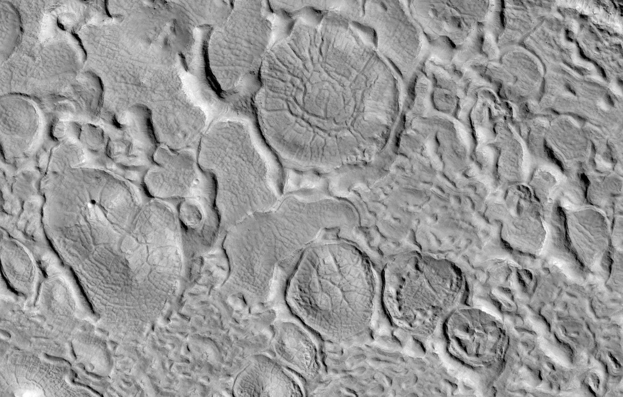
Mars is an intriguing planet that has captivated scientists and space enthusiasts alike. Its mysterious landscape is filled with fascinating features that have been shaped by billions of years of erosion and other geological processes. This image from NASA's High Resolution Imaging Science Experiment (HiRISE) camera shows bizarre icy landforms on the Martian middle latitudes (about 30-50 degrees North and South), where significant ground ice has formed and temperatures may have been high enough in the recent past for the ice to melt and flow.
This landscape appears to have been formed by a combination of ice expansion and contraction, sublimation, and flow, as evident by the roundish landforms covered by polygons and surrounded by trenches.
This picture was shared by the HiRISE team on Twitter on Thursday, January 19.
HiPOD: Bizarre Icy LandformsThis image shows roundish landforms covered by polygons and surrounded by trenches. Some combination of ice expansion and contraction, sublimation, and flow may have created this landscape. https://t.co/hl9cS4P19CNASA/JPL-Caltech/UArizona#Mars pic.twitter.com/PYW7joKwGP
— HiRISE: Beautiful Mars (NASA) (@HiRISE) January 19, 2023
NASA's HiRISE camera is an instrument aboard the Mars Reconnaissance Orbiter (MRO) spacecraft. Launched in 2005, it is the most powerful camera ever sent to another planet. It is capable of capturing images of the Martian surface with resolutions as high as 0.3 meters per pixel, allowing scientists to study the geology, morphology, and topography of the planet in unprecedented detail.
HiRISE has been used to map out the Martian terrain, identify potential landing sites for future missions, and even capture images of the Curiosity rover as it explored the Martian surface. HiRISE has revolutionized humanity's understanding of Mars and continues to provide invaluable data to scientists around the world.
The HiRISE camera was built by Ball Aerospace and Technology Corporation and is operated by the University of Arizona.


