Soil erosion plays major role in Tanzania flooding, says World Bank study
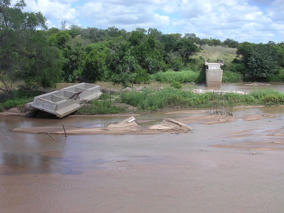
Plaguing the Msimbazi River basin that snakes through the city’s centre, soil erosion enables water to escape the confines of the river’s natural borders. It also produces sedimentation, which obstructs river flow and increases flooding over time.
- Country:
- Tanzania
During the first few months of each year in Tanzania, the mood around urban centres like Dar es Salaam is one of dread due to the impending arrival of the rainy season. Around this time, headlines report a toll of losses related to flooding - of assets, of critical infrastructure, and of life.
Recent World Bank studies have identified many contributing factors to the increasing impact of flooding in Dar es Salaam. Soil erosion, historically under-addressed, plays a major role. Plaguing the Msimbazi River basin that snakes through the city’s centre, soil erosion enables water to escape the confines of the river’s natural borders. It also produces sedimentation, which obstructs river flow and increases flooding over time. This has disastrous effects on settlements along the river banks – many of which are informal and low-income. Community-led efforts to reinforce the collapsing riverbanks have involved the intentional dumping of solid waste, a makeshift solution that has further exacerbated the issue.
To analyze the extent of erosion along the river and better visualize the impact of potential interventions, the Tanzania Urban Resilience Programme, a DfID-funded initiative jointly implemented by the World Bank and the Government of Tanzania, is conducting flood modelling for the city. With accurate flood models, decision makers will be better able to design sustainable solutions for the basin. However, experts have noted that modelling accuracy has been hindered by an outdated soil map.
“Flood modelling has not often shown the whole story for Dar es Salaam as the soil map does not reflect the impact of urbanization,” said Mussa Natty, an engineer and former municipal director supporting program activities. “Only one general soil type has been considered by decision makers in the past – this severely limits the accuracy of analysis as it doesn’t account for how the soil in different areas reacts differently to water.”
Traditional programs would have employed costly international expertise to fill this data gap. Advocating instead for the adoption of affordable and local solutions to flooding in Dar es Salaam, the World Bank’s Urban Resilience team is using citizen science for the task. A team of 16 young professionals and students leads the initiative, adopting open web applications and simple measurement tools for the physical collection of samples. These samples have been gathered from 643 strategic points across the city, covering an area of over 2,752km².
“The process demands that we test soils from different areas around Dar es Salaam in order to determine the different soil profiles, which will ultimately help us understand how water will affect each soil type,” said Sia Salonga, one of the young samplers engaged in the project.
“These profiles show us which areas are most susceptible to erosion, which are experiencing the most erosion, and how this influences flooding and river dynamics,” added Natty.
After just two months of sampling, the team has recorded over 600 different soil types across the city—providing data that has been made open and free for public use. The resulting soil map will inform a comprehensive sedimentation study of Dar es Salaam, and the actions that need to be taken regarding urban development around the Msimbazi River.
“We can see where some tree planting will be needed, maybe we need to add in some grassy areas, or maybe we need to stop some urban development because certain areas are really susceptible to high erosion rates. These are some of the things we can consider with this data,” said Natty.
As use cases emerge, this project aims to prove that critical disaster risk data collection does not have to be outsourced—that local knowledge and tools can support successful and sustainable solutions, and the capacities of young, aspiring practitioners can be nurtured in the process.
“Flooding is a reality for us all in Tanzania,” said Salonga. – “I’m very grateful for the opportunity to participate in an initiative that will help leaders make informed decisions for our communities.”
ALSO READ
KCR Slams Congress Government Over Water Rights and Project Halts
Daring Rescue: Wild Fox Saved from Water Tank Ordeal
Bridgewater Associates to Launch Major Employee Ownership Program
ADB Approves $3m Grant to Boost Irrigation, Tackle Water Shortages in Sri Lanka
Bridgewater Associates Elevates Employee Ownership Amidst Strategic Transformation


